QLD 7376-2 Online Sale
- Estimated Delivery : Up to 4 business days
- Free Shipping & Returns : On all orders over $200
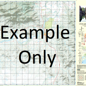
This Topographic Map is produced by the Department of Natural Resources and Mines (DNRM), part of the Queensland Government.
This product is continously updated with the latest information available. New editions are generally published in Oct Nov each year, however minor updates are constantly being included.
DNRM maps are produced automatically by computers, with minimal human oversight; so some duplication of information and occasional minor cartographic inconsistencies can be found.
The PDF version of this can be printed at home or sent to a professional printer for a 100% scale reproduction.
At this scale, 2cm on this map represents 1km on the ground. A standard map (which is square) covers an area of approximately about 25km by 25km, with a contour interval of 10m. This map contains natural and constructed features including road and rail infrastructure, vegetation, hydrography, contours, localities and some administrative boundaries.
Bamaga New Mapoon Umagico Injinoo Aloa Barn Island Biffin Creek Brady Banks Burster Creek Cody Creek Cody Hill Cowal Cowal Creek Dayman Island Fishbone Creek Galloways Hill Heroine Rock Herring Creek Ichera Head Jackey Jackey Airfield Jackey Jackey Creek Karniga Island Laradeenya Creek Lockerbie Loggan Creek Markilug Islet Marou Creek Mission Hill Mosby Creek Mouinndo Islet Mutee Head Nona Creek Paterson Creek Mount Paterson Red Island Red Island Point Seisia Seymour Simpson Bay Somerset Spear Creek Tuluaa Islet Wasp Creek Wilson Creek Woomera Creek Wuwurrka Islet Wassel Island Wuwurrka Island Markilug Island Otuckano Creek Lockerie Paterson Hill Endeavour Strait Mouinndo Rock Parau Island Jamunnda Cowal Creek Mission Station Mutee Mission Mutee Mission Station Ichera Point Black Gin Creek
| Title | Paper, Laminated, Pdf Download |
|---|
Related products
-
QLD 7056-14 Online
$12.50 -
QLD 7056-41 Discount
$12.50 -
QLD 7056-21 For Sale
$12.50 -
QLD 7057-13 Online Hot Sale
$12.50 -
QLD 7057-44 Hot on Sale
$12.50